
Author(s): Mehmet Akif TAÅ, Mehmet Akif CEYLAN
In this study, the effects of the flood disaster that occurred in the Melen Stream Basin on 17-18 July 2019 and caused significant loss of life and property in the villages of Esmahan?m, U?urlu, Davuta?a and Dilaver in the Akçakoca district of Düzce province were examined. The impact area of the flood was determined by examining the satellite images (Landsat 8 and Sentinel 2) obtained from international organizations such as USGS, ASF Alaska, Remote Sensing (UA) and Geographical Information Systems (GIS) software such as ArcMap Pro and Google Earth. It has been determined that U?urlu, Esmahan?m, Dilaver and Davuta?a villages, which are located in the basin of Esmahan?m Stream, which is a tributary of the Melen Stream, and which cover an area of approximately 2 km2 in terms of settlement area, were greatly affected by the flood and were not prepared for sudden rainfall and floods. Although the area studied is compared to the total area (270 km2 in terms of administrative boundaries), a very small section seems to have been subjected to flooding, when the calculations are made on the basis of the area covered by the settlements (2 km2) , it was found that flood disaster was effective and a large section reaching 50% was damaged in the mentioned settlements has been. In this respect, it is recommended to evaluate the data collected before and after the flood in a sensitive and up-to-date manner and to take necessary measures by applying various analyzes in order to prevent flood disaster.

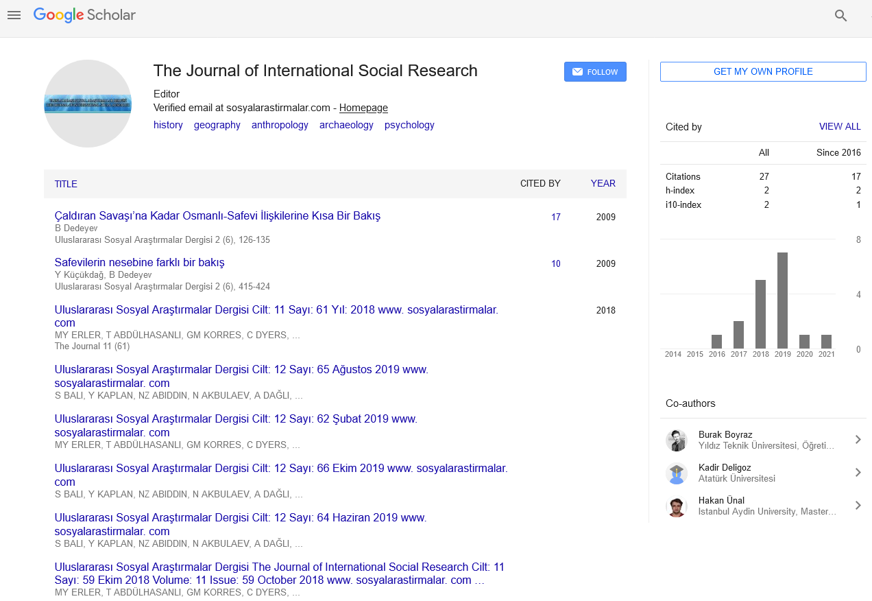
The Journal of International Social Research received 8982 citations as per Google Scholar report