
Author(s): Mustafa KAHRAMAN
Cities have undergone a major change in the last century. One of these changes in the city is the changes in the street names. In this study, these changes will be discussed in the context of Istanbul City. In the first stage of the study, the names of the streets in Istanbul were determined between 1913-1914. In the determination of the streets and their names in 1913-1914, maps called German Blue were used. The German Blue, is coordinated with the ArcGIS 10.3 program and the names of each road are identified and digitized. In the next stage, the current name of each road has been determined. Accordingly, the name of 2164 streets and 939 of the streets have changed completely, the name of the partially changed 854 of them remained the same. While the names of the streets and streets change at least around Galata Tower and Karaköy, Tarlaba?? is the place where street and street names change at least. In order to better analyze the changing roads in the study, the names of the roads that can be identified in 1913-1914 and the present names of those roads were subjected to a grouping. As a result of this grouping, the roads between 1913-1914 were divided into 12 and today's roads were divided into 15 different groups and examined comparatively. As a result of this study, it was observed that the spatial effects were higher in the naming of streets and streets in 1913-1914, and today, it was observed that people who had important works for the state were more effective in naming the streets and streets.

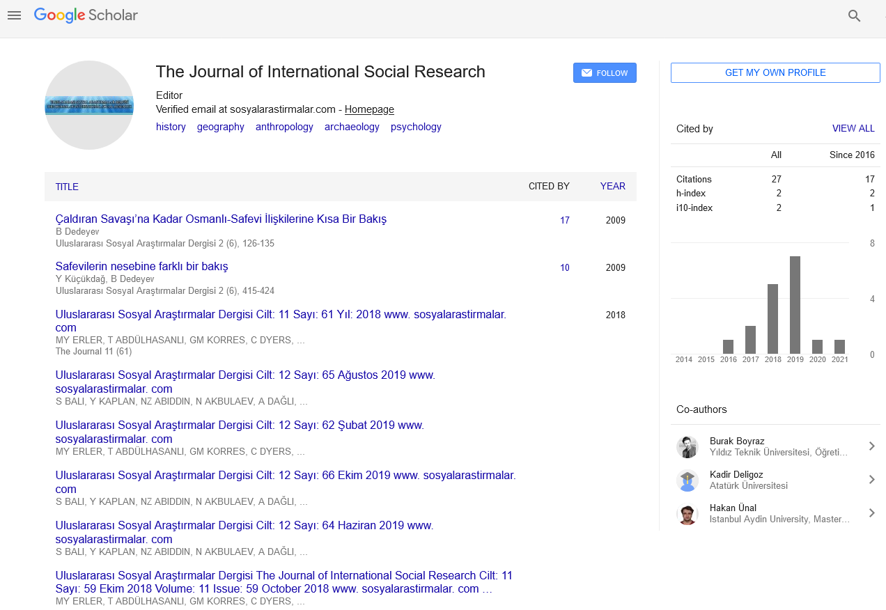
The Journal of International Social Research received 8982 citations as per Google Scholar report