
Author(s): Ä°smail EGE
The Study area is located in the Mediterranean region and its sub region Adana. Its far of the Feke district is 18 km East direction and in the east part of Middle Taurus. Pa?al? Polje is (UTM: 251442 E, 4179840 N) 37°43'56"N latitude and 36°10'46"E longitude in terms of Geographical Coordinate System. Pa?al? Polje which extents NE-SW direction demonstrates parallelism in respect of direction Middle Tours. It is 880-930 m. from sea level. The Polje has been shaped with carstification, erosion and tectonic movements in the Upper Miocene Conglomerates. Poljes have been shaped with carstification, physical erosion and tectonic movements/lines. Pa?al? Polje has been occurred with faults which are formed between Misis and Göksu. This polje is different more than some other poljes because it has formed Upper Miocene Conglomerate rocks. This Formation covers more than other old formations in terms of angular incongruous. This is because Carstification landforms and term of carstification are very different on the Paleozoic, Mesozoic, Cenozoic limestones and Gympus. Conglomerate Rocks have very different Carstification landforms and period of carstification. The aim of in this study it to determine geomorphological features, to introduce carstification on the Miocene Conglomerates, to evaluate tourism potential and land use situation on the Pa?al? Mountain/Polje.

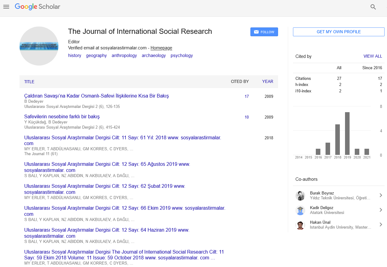
The Journal of International Social Research received 8982 citations as per Google Scholar report