
Author(s): Savaà  ÃÂAÃÂLAKÃĒÂÂĒ Tamer ÃÂZLÃÂ** Sercan GÃÂNDÃÂZ
In this study, it is aimed to determine the climatic characteristics of Sanl?urfa and to map these characteristics with interpolation techniques. In our study, Radial Basis Function and Nearest-Neighborhood Methods, which provided about 95 % accuracy rate of 47 years of average value, are applied. To apply these methods, at least 10 meteorological station data are needed. In this study 14 positional point data are used. It is aimed to prepare the climatic elements of maps that is needed in Sanl?urfa. Nearly 20 maps are prepared during our study. The spatial dispersion of all climatic elements is determined. The effects of planetary and local geographic conditions on spatial dispersion of the climatic elements are evaluated via maps. In Sanl?urfa, where generally two different climatic zones are formed; it is mapped that by expansion of the Atatürk Dam and irrigation fields the effects of humidity are also expended. It is understood clearly from the statistical that due to the increasing elevation and orography towards Karacadag Mountain, the precipitation values are also change. This situation shows that the region is affected by the atmospheric weather conditions and local geographical factors.

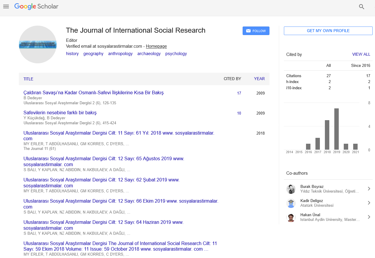
The Journal of International Social Research received 8982 citations as per Google Scholar report