
Author(s): Murat UZUN* Sibel ÃZCAN*
In this study, panoramic photograph making to analy?s of quantitative referance in using of geographic studies, to explained feature of panoramic photograph and to provide benefits of geography, to explained using tracts in geography and finally How are make simply panoramic photo. The maps and phtograph using with different a lot of material in geography.Photographies visualize to space, land, topography, city and a lot of geographic elements, therefore provide to using of geography. Panoramic photos, provides wide-angle images, by combining several frames taken from a single high-resolution images are obtained, detailed observations and analysis are made, improve literacy, provide permanent learning in education and training with the visual sensory organ, to accelerate the production and knowledge transfer process, increase the perception of reality and usability. This features, panoramic photography create to provide of geography. Many contributions to the geography of the past have led to the present panoramic photographs used in work-in publication of these images. Therefore, this study examined a total of 2236 publications in journals and 378 all counted eight different regions have been identified as a panoramic photograph is used. Panoramic photos are used in all sub-disciplines of geography. However geomorphology of the photo (49%) and settlement geography (16%) in the condensation, determine the use of the panoramic photo in the fields of geography and today show that more beneficial to these areas. Past manually produced panoramic photos, especially nowadays many software Photoshop software, can be produced in the special panoramic cameras and smartphones. Production of panoramic photos is easy, advantages, benefits and opportunities provided by the region is projected to increase the use of panoramic photos.

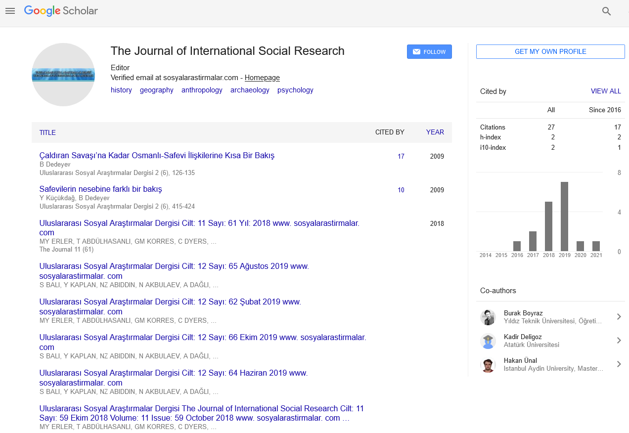
The Journal of International Social Research received 8982 citations as per Google Scholar report